Learn how to get more out of Beamo with Plans and Packs.
Introduction
After finishing the survey, the plan list will be displayed. Check the surveys with the number of points captured and Tags added to each plan.
Who can use this feature?
| Super Admin | Site Manager | Team Admin | Surveyor | Collaborator | Viewer | |
| Mobile App |
Importing images from 360° camera

1. Select the survey.
2. Tap [Import Data![]() ].
].
When importing completes, the notification “Import Completed” will be displayed at the bottom.
Notes : App should be connected to 360° camera that captured the survey.
Uploading data to Beamo Portal

3. Go to the Wi-Fi setting in the smartphone to connect back to the internet.
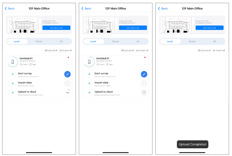
4. Tap [Upload to cloud![]() ].
].
5. Check the uploading progress displayed with %. The survey will be processed automatically once the upload is completed.
6. Once uploaded, “Upload Completed” will be displayed. Check the survey by tapping either the [Portal] or the [All] tab.
Caution: You cannot pause uploading. Canceling in the middle of uploading means a re-upload of all 360 images of the plan.